


Voting District 20155, San Mateo County, California
About
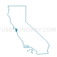
Outline

Summary
| Unique Area Identifier | 543004 |
| Name | Voting District 20155 |
| County | San Mateo County |
| State | California |
| Area (square miles) | 1.57 |
| Land Area (square miles) | 1.42 |
| Water Area (square miles) | 0.14 |
| % of Land Area | 90.83 |
| % of Water Area | 9.17 |
| Latitude of the Internal Point | 37.54604970 |
| Longtitude of the Internal Point | -122.26115040 |
Maps


Graphs
Select a template below for downloading or customizing gragh for Voting District 20155, San Mateo County, California


Neighbors
Neighoring Voting District (by Name) Neighboring Voting District on the Map
- Voting District 20145, San Mateo County, CA
- Voting District 20150, San Mateo County, CA
- Voting District 20185, San Mateo County, CA
- Voting District 20210, San Mateo County, CA
- Voting District 30325, San Mateo County, CA
- Voting District BAY, San Mateo County, CA
Top 10 Neighboring County Subdivision (by Population) Neighboring County Subdivision on the Map
Top 10 Neighboring Place (by Population) Neighboring Place on the Map
- San Mateo city, CA (97,207)
- Redwood City city, CA (76,815)
- Foster City city, CA (30,567)
- Belmont city, CA (25,835)
Top 10 Neighboring Elementary School District (by Population) Neighboring Elementary School District on the Map
- San Mateo-Foster City Elementary School District, CA (129,099)
- Belmont-Redwood Shores Elementary School District, CA (40,835)
Top 10 Neighboring Secondary School District (by Population) Neighboring Secondary School District on the Map
Top 10 Neighboring State Legislative District Lower Chamber (by Population) Neighboring State Legislative District Lower Chamber on the Map
Top 10 Neighboring State Legislative District Upper Chamber (by Population) Neighboring State Legislative District Upper Chamber on the Map
Top 10 Neighboring 111th Congressional District (by Population) Neighboring 111th Congressional District on the Map
Top 10 Neighboring Census Tract (by Population) Neighboring Census Tract on the Map
- Census Tract 6080.04, San Mateo County, CA (6,521)
- Census Tract 6084, San Mateo County, CA (5,546)
- Census Tract 6086, San Mateo County, CA (4,359)
- Census Tract 6080.13, San Mateo County, CA (4,049)
- Census Tract 6103.04, San Mateo County, CA (4,023)
- Census Tract 6082, San Mateo County, CA (3,614)
- Census Tract 6080.02, San Mateo County, CA (3,517)
- Census Tract 6083, San Mateo County, CA (3,401)
- Census Tract 6080.01, San Mateo County, CA (3,393)
- Census Tract 6080.23, San Mateo County, CA (2,549)